D6.8 Recommendations for future work
Document
Deliverable
Work package/Task
Content Access
This workpackage is concerned with a) the assessment of gaps in capabilities or knowledge relevant to the use of non-satellite data to characterise satellite measurements and b) user engagement.
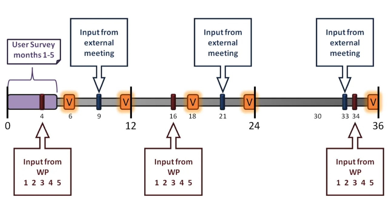
The assessment of gaps and their impacts shall be performed iteratively throughout the project lifetime based upon input from both underlying workpackages and external users. This gap assessment shall then be used to develop a set of prioritised recommended remedies. Users will be engaged through a user survey and a series of user workshops. The workpackage shall:
While it is necessary to address technical and organisational gaps that reduce the availability, effectiveness, and quality of satellite characterisation data, such improvements need be exploited by a sufficient workforce capacity to develop and deliver products and services to the marketplace.
Many non-satellite reference measurements have the potential to be operated on a continuous basis, or can at least be made available to operate at any time, even if in practice they cannot take uninterrupted observations, e.g. because the measurement technique requires certain geophysical conditions. Providing continuous observations to the extent possible would maximise opportunities for the validation of satellite-based measurements, as well as higher level data products derived from them.
There are many non-satellite measurement systems that, in principle, could be used for the purposes of satellite characterisation on a sustained basis. Such measurements are metrologically well characterised and understood. They often measure variables, which are measured or measurable from space. However, many of the measurement systems are discontinuous (discrete) in time and their measurement scheduling is typically made with no regard to satellite-overpass times.
As a result of fractured governance along with historical funding decisions, the geographical spread of observation systems, which may, in principle, be synergistic, are not presently sufficiently optimised in order to realise the potential benefits for numerous research applications, including, but not limited to, satellite cal/val. For example, a twice-daily radiosonde program may currently be undertaken 100km from a facility with lidars and an FTIR.
Current governance of high-quality measurement programs is highly fractured. Numerous networks exist at national, regional, and global levels that have been set up and funded under a variety of governance models. This fractured management of observational capabilities can lead to, amongst others: redundancies, spatiotemporal gaps, varied data policies and formats, varied data processing choices, and fractured provision of data.