This workpackage is concerned with the assessment and mapping of non-satellite measurement capabilities and the assessment of geographical gaps. Recognising that there is a continuum of measurement capabilities of Essential Climate Variables(ECVs) across the multiple networks that constitute our global observational system, the workpackage shall:
- Define assessment criteria for a system of systems consideration of observational capabilities (task 1.1).
- Assess available metadata and assign above criteria to observational networks and their instrumentation (task 1.2).
- Produce a graphical interface to enable users to investigate observational capabilities (task 1.3).
- Undertake statistical (task 1.4) and model-based (task 1.5) assessments of geographical gaps and the implications upon our ability to characterise satellite-based measurements.
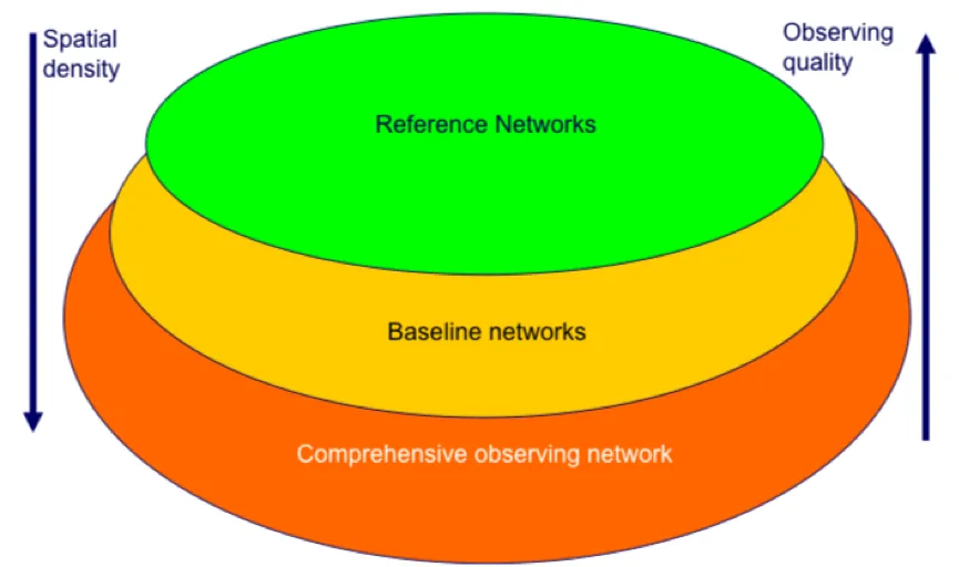
Figure: Posited system of systems approach to observing system maturity arising from Task 1.1.
This workpackage is concerned with improving our metrological characterisation of measurements of GAIA-CLIM target Essential Climate Variables (ECVs). To enable a comprehensive comparison between a satellite and non-satellite measurement requires a full metrological characterisation of at least one of the two measurements (reference-quality data). A full characterisation requires an unbroken chain of measurement processing to SI or accepted standards and a quantification of the uncertainty in each step. The workpackage shall:
- Create, to the extent possible, fully traceable reference-quality measurements for a number of measurement techniques that are close to such maturity (Task 2.1).
- Analyse existing comparisons and observations to provide more indicative uncertainties for observations from the remainder of the global observing system capabilities (Task 2.2).
- Undertake metrological auditing and produce best practices documentation for improving instrument characterisation (Task 2.3).
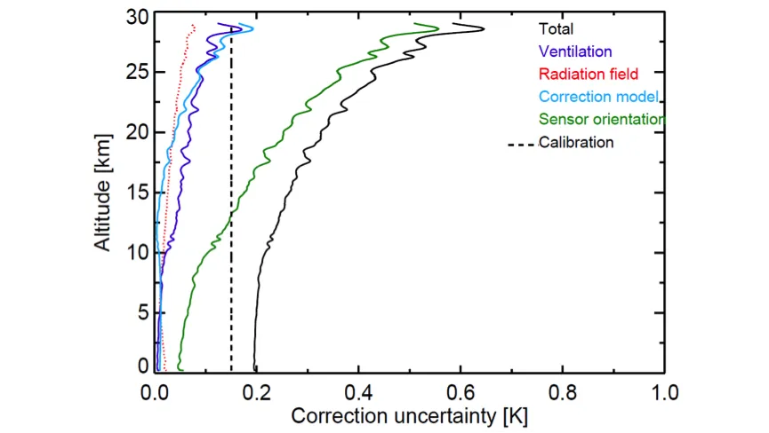
Figure: Example metrological characterisation of a radiosonde profile from Dirksen et al., 2014.
First traceability model diagrams can be found here.
Product Traceability and Uncertainty (PTU) documents can be found here.
This workpackage is concerned with improving our quantification of irreducible uncertainties that arise from inevitable non-coincidence of satellite and non-satellite measurements. The measurements may occur at slightly different times or locations or measure different volumes. Because the atmosphere is a dynamic fluid system any mismatch will lead to a difference that arises from changes in the atmospheric state. These differences must be accounted for in any meaningful comparison between the satellite and non-satellite measurements if reliable inferences are to be made. The workpackage shall:
- Characterise the uncertainties arising for single instruments (Task 3.1).
- Characterise the uncertainties arising for more spatially comprehensive network comparisons (Task 3.2).
- Develop software tools to enable the use in the forthcoming “Virtual Observatory” (WP5, Task 3.3).
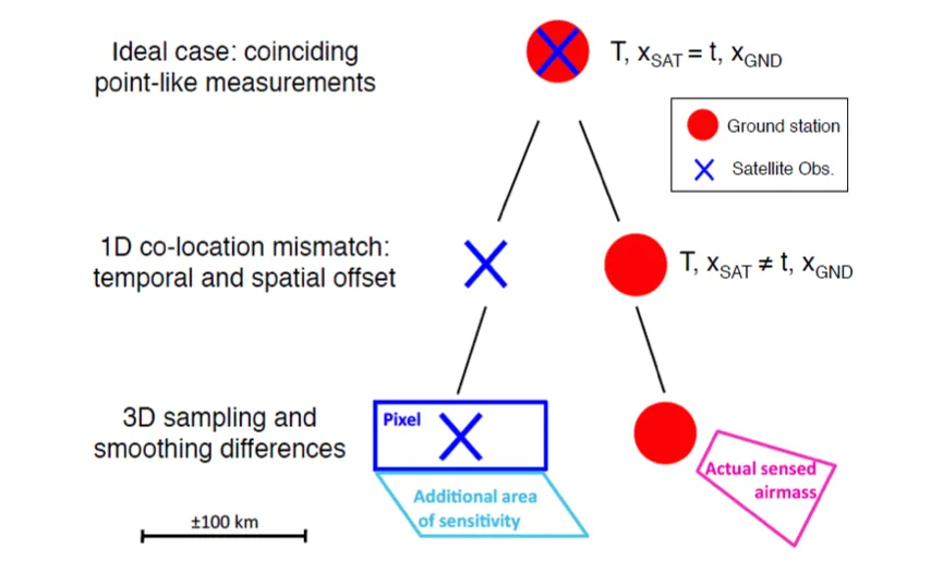
Figure: Conceptual visualisation of the metrology of a satellite-ground measurement comparison Verhoelst et al., 2015.
This workpackage is concerned with the potential utility of data-assimilation systems used in Numerical Weather Prediction (NWP) and reanalyses to use reference-quality data to make geographically broader implications about satellite-observational performance. The workpackage shall:
- Assess the performance of a number of new satellite systems using reference-quality data and data assimilation (Task 4.1).
- Develop infrastructure for near-real-time acquisition of reference-quality data (Task 4.2).
- Develop software systems to enable monitoring of reference-quality data streams using global data assimilation systems (Task 4.3).
- Develop a more general approach to use of reference-quality data in data assimilation, including for oceanic and terrestrial Essential Climate Variables (ECVs) (Task 4.4).
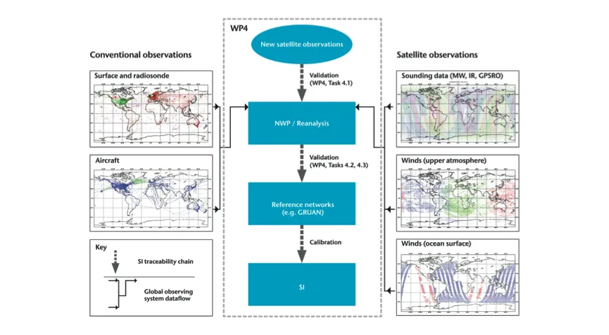
Figure: Conceptual illustration of the potential route by which data assimilation can be used together with reference-quality measurements for assessments of satellite-data quality.
This workpackage is concerned with enabling user access to and use of satellite to non-satellite data comparisons through a “Virtual Observatory” facility. A range of visualisation and analysis tools will be developed to enable users to explore, analyse, and interact with the data. The Virtual Observatory shall be built to showcase potential methods by which the underlying scientific advances in workpackages 1 through 4 can be realised. It will be built in such a way that it could subsequently become an operational service, but within this project shall only serve as a proof-of-concept facility. The workpackage shall:
- Create a collocation database of reference-quality non-satellite measurements and satellite measurements (Task 5.1).
- Build a graphical user interface and user tools (Task 5.2).
- Evaluate the resulting Virtual Observatory facility (Task 5.3).
- Produce a transition roadmap of additional steps required to make the Virtual Observatory operational (Task 5.4).
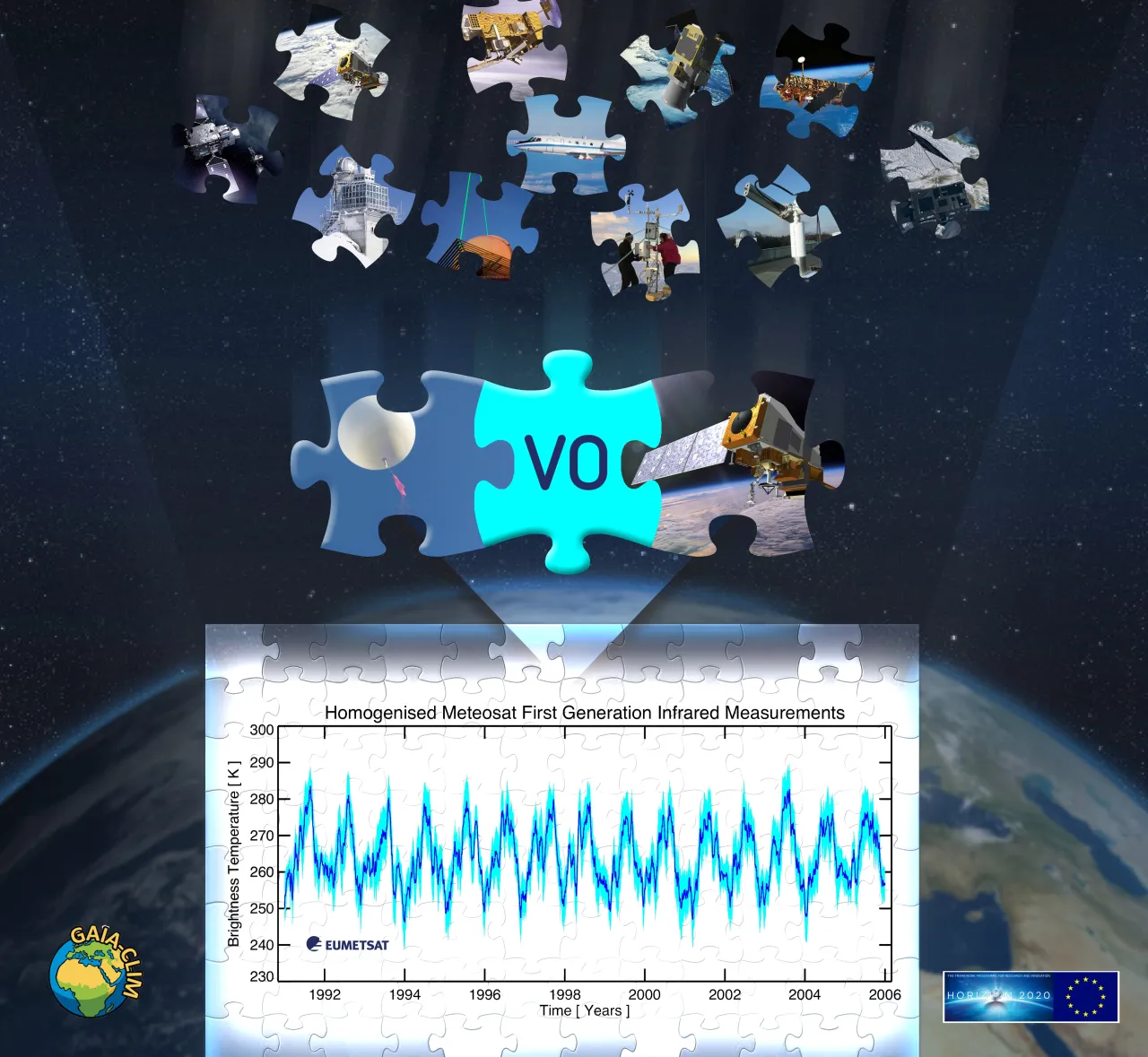
Figure: Front page of the Virtual Observatory facility.
This workpackage is concerned with a) the assessment of gaps in capabilities or knowledge relevant to the use of non-satellite data to characterise satellite measurements and b) user engagement.
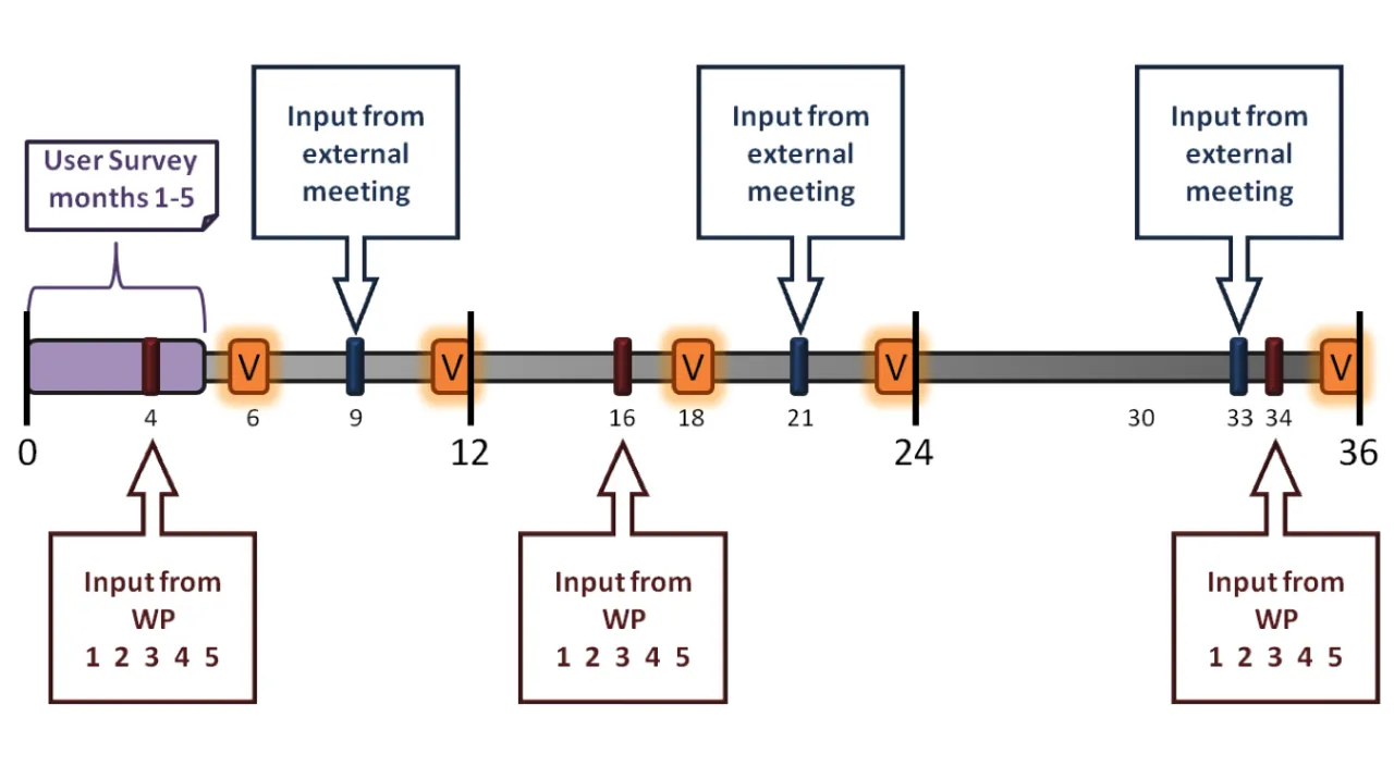
The assessment of gaps and their impacts shall be performed iteratively throughout the project lifetime based upon input from both underlying workpackages and external users. This gap assessment shall then be used to develop a set of prioritised recommended remedies. Users will be engaged through a user survey and a series of user workshops. The workpackage shall:
- Engage users through a survey and series of user workshops (Task 6.1).
- Produce and iterate upon a living Gaps Assessment and Impacts Document (GAID; Task 6.2).
- Prioritise potential gap remedies and improvements in capabilities (Task 6.3).
GAIA-CLIM is coordinated by NERSC and Maynooth University.
A series of email lists exists for individual task teams and workpackages, as well as for institutional contacts. An overview on all GAIA-CLIM mailaing lists can be found here.
